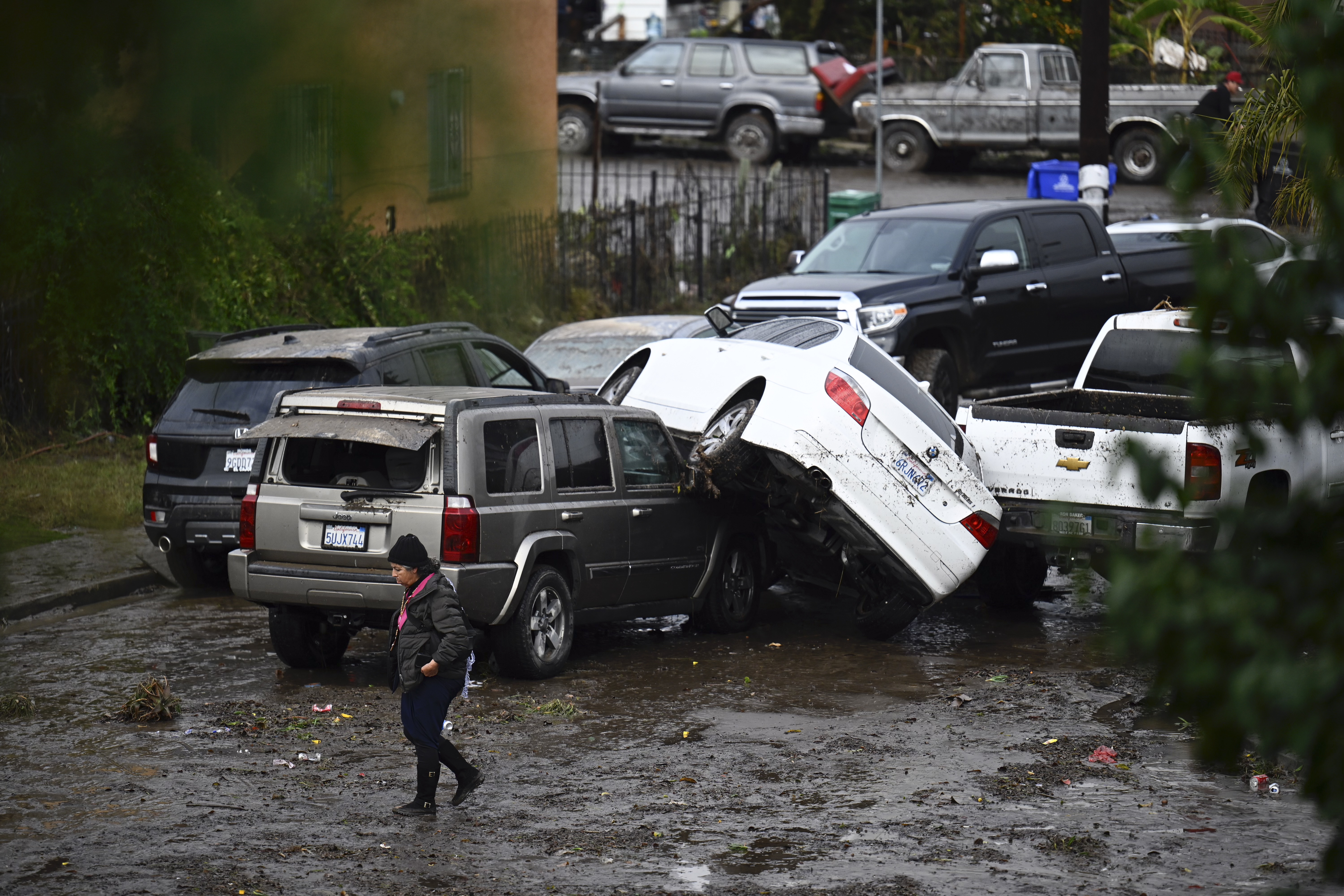
The chilly winter storm that arrived in the San Diego area over the weekend delivered steady downpours along with widespread flooding that swamped roadways and neighborhoods across the region.
It was the fourth-wettest day on record in the entire history of San Diego weather measurements, according to the NWS. San Diego has gotten more rain over the past three days than during the past three months combined. In fact, the three-day total has nearly doubled in the past three months.
But why was there so much flooding in Coronado, National City and the surrounding areas? NBC 7's Meteorologist Sheena Parveen has the answer: training.
Get San Diego local news, weather forecasts, sports and lifestyle stories to your inbox. Sign up for NBC San Diego newsletters.
Training is when heavy rain moves over the same area for an extended period of time, leading to flash flooding. Training can and does easily occur in many large storm systems in the county, as long as that storm has ample moisture content and the direction of motion allows for heavy rain to be directed over the same area. No two storms are alike, so training cannot typically be predicted in a given location prior to the storm moving in.
In this case, there was a line of heavy rain and thunderstorms that were moving east over Coronado and National City. The rainfall rate inside that area of heavy rain was 1-2 inches per hour. Training leads to flash flooding almost 100% of the time, Parveen said.

Combined with the city's "aging stormwater system with limited capacity," and we saw many homes flooded, along with cars, and even our transportation services were affected.
Many of the city's stormwater pump stations reached capacity during the rain event and flooding caused power outages at the pump station in the Sports Arena/Midway district, the city of San Diego said.
Here's a more detailed breakout of Parveen's explanation:
On Jan. 22, a large and complex weather system impacted the West Coast. An area of low pressure was also near San Diego County. A band of subtropical moisture (shown in the yellow arrows on the image below) increased moisture content into this storm system as it approached land.

The radar image below shows when rain began moving into San Diego County, around 6 a.m. Monday. Green shows light rain, yellow is moderate, orange is heavy, while red is very heavy.

At 9am, there were numerous areas of moderate to heavy rain across the county.

By 10 a.m., flooding was already occurring across the county with a weather phenomenon called "training" in Coronado, National City and adjacent areas. Training is when heavy rain moves over the same area for an extended period of time, leading to flash flooding. Training can and does easily occur in many large storm systems in the county, as long as that storm has ample moisture content and the direction of motion allows for heavy rain to be directed over the same area. No two storms are alike, so training cannot typically be predicted in a given location prior to the storm moving in.

By 12 p.m., dry air began to move in as the storm system pulled most of the moisture away.

Closer look at Coronado and surrounding areas:
Heavy rain began to move into Coronado and areas around downtown San Diego shortly after 8 a.m., shown in the yellow.

With ample moisture content in the atmosphere, very heavy rain was occurring by 10 a.m. in these same areas with precipitation rates of 1-2 inches per hour.

The weather phenomenon called training was occurring shortly after 10 a.m. as the storm began to form a long line of very heavy rain, all moving in the same direction, mainly from west to east.

The image below shows almost two hours after heavy rain began in this area, now with even heavier rain moving over the same sections of land. This rainfall was still averaging 1-2 inches per hour.

By 10:30 a.m., heavy rain was still falling but the storm system was on its way out.

This system had ample moisture and a zonal flow (west to east). which helped create the process of training over portions of San Diego County. If heavy rain causes flash flooding in an area with poor drainage or an area that is prone to flooding during heavy rain, then this type of an event would make it exponentially worse.
See more of our storm coverage below: