
San Diego’s latest storm reached the region overnight Tuesday, bringing rain and gusty winds with the potential for some afternoon thunderstorms.
At 12:30 p.m., the National Weather Service issued a Special Marine Warning for coastal waters from San Mateo Point to the Mexican border. The warning expired a half-hour later and alerted those on the water that a severe thunderstorm off Carlsbad was moving northeast rapidly and was capable of forming waterspouts.
By 2:30, CalTrans had issued a high-wind advisory to the drivers of high-profile vehicles, advising them that big rigs should not be driven on Interstate 8 between Alpine and the Imperial County line at this time.
Get San Diego local news, weather forecasts, sports and lifestyle stories to your inbox. Sign up for NBC San Diego newsletters.
The region experienced light showers during the morning commute Tuesday. During the afternoon, there is ll be a decent chance for thunderstorms, NBC 7 Meteorologist Sheena Parveen said. Any storms around could provide high winds, heavy rain and lightning. There will also be a slight chance of hail. These storms should not last long, as we begin to dry up through the evening.
"As we head through the day, we're going to be seeing scattered showers with a chance of thunderstorms. It's going to be pretty windy, too," Parveen said.
A high wind advisory is in effect until 4 p.m. Tuesday while a high surf advisory is in effect until 10 p.m. Wednesday.
Some gusty weather is expected in East County, with peak gusts as high as 65 mph in places such as Borrego Springs, Mt. Laguna and Jacumba Hot Springs, with slower gusts of 25 mph throughout San Diego, Chula Vista, El Cajon and Escondido.
The National Weather Service estimates the majority of the county will get less than an inch of precipitation from this storm, with the exception of Palomar Mountain, which could get up to 2.5 inches.
"An intense storm system is producing widespread torrential rain across the central CA coast today; rain will expand farther south tonight- Tue.," the NWS' San Diego office Tweeted on Monday.
As of 7 p.m., the NWS measured the following three-day rain totals across San Diego County mountains:
- Palomar Observatory: 3.58 inches
- Birch Hill: 2.52 inches
- La Jolla: 1.81 inches
- Lake Cuyamaca: 1.70 inches
- Julian: 1.51 inches
And in the valleys:
- Rainbow: 1.55 inches
- Deer Springs: 1.18 inches
- Valley Center: 1.15 inches
- Skyline Ranch: 1.09 inches
- Fallbrook: 1.05 inches
- Escondido: .75 inches
And along the coasts:
- San Onofre: 1.08 inches
- Carlsbad: .73 inches
- Oceanside: .71 inches
- El Camino Del Norte: .53 inches
- San Marcos: .5 inches
A series of powerful storms is expected to pass through Northern California this week. An atmospheric river event pounded Northern California last week, causing flooding, power outages and heavy snowfall in the mountain areas.
President Joe Biden approved an emergency declaration for California on Sunday and authorized the Federal Emergency Management Agency to coordinate disaster relief efforts and provide emergency resources, the White House said in a statement.
"We expect to see the worst of it still in front of us," Gov. Gavin Newsom told the Los Angeles Times Sunday. "We're anticipating very intense weather coming in [Monday] and Tuesday morning."
Partly sunny skies will return Wednesday and Thursday, but more rain is possible next weekend, possibly as early as Friday night, according to the NWS.
In the San Diego area, temperatures will stay cool throughout the week, with highs in the lower to mid 60s. Overnight lows will mostly be in the 50s.
Last Week's Powerful Storm
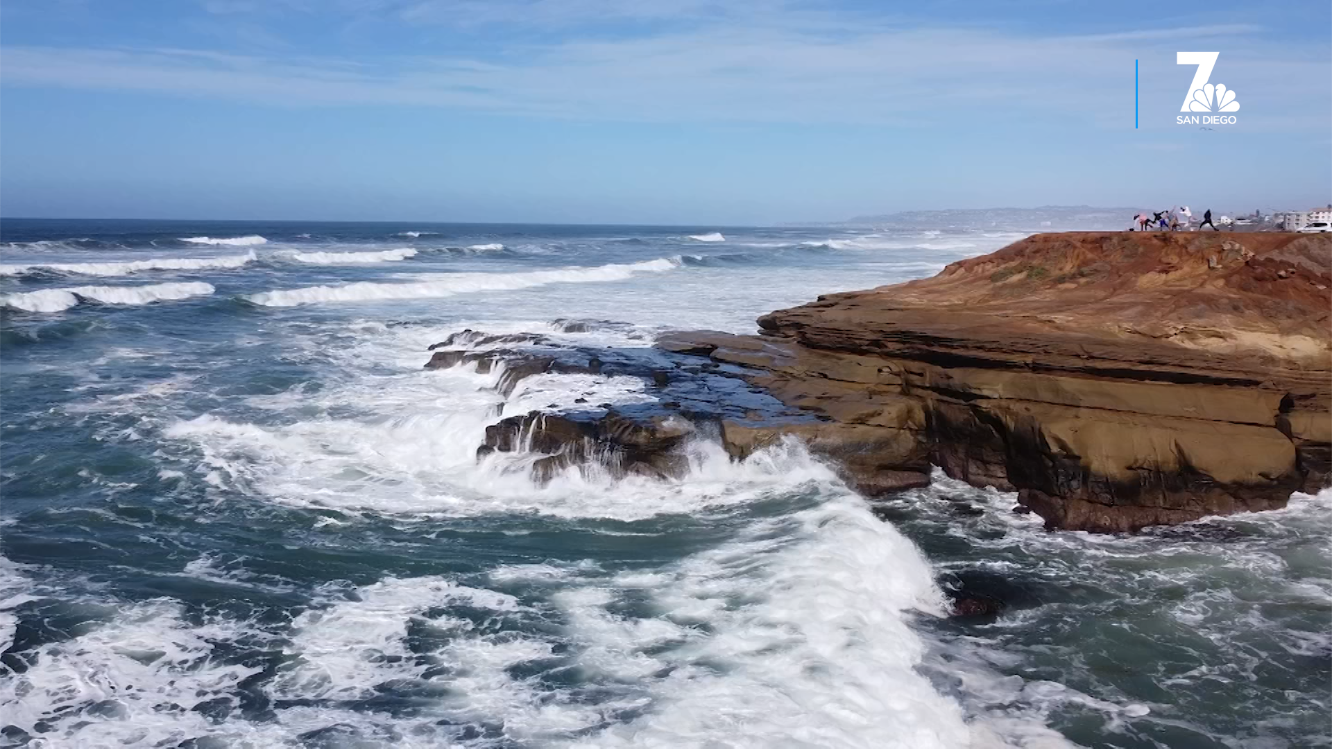
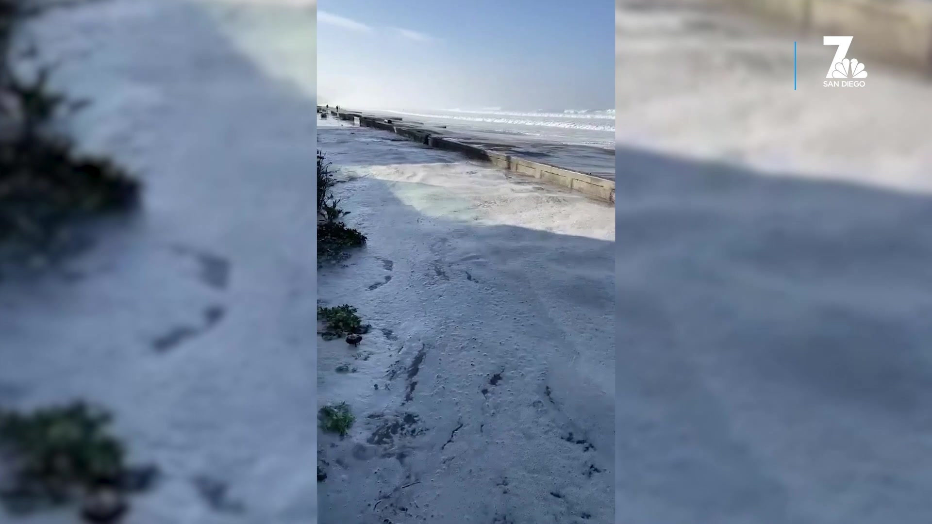
The waves at local beaches will not be as powerful as the ones generated last week by the bomb cyclone, but will still be large, reaching 7 feet Monday, 8 feet Tuesday and as big as 9 feet the following day.
Surf will remain high for the rest of the week and into the weekend. Another round of storms moves into the county this weekend and early next week, so expect even more rain chances ahead.
The City News Service contributed to this report — Ed.
