


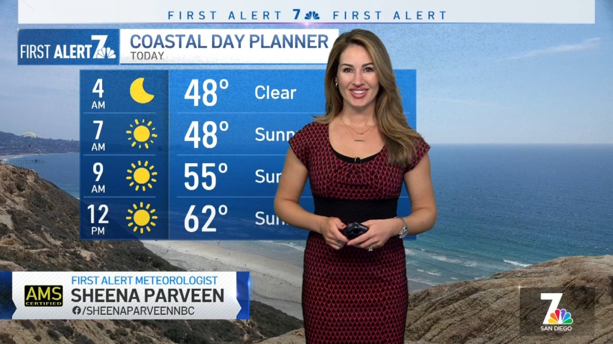
Sheena Parveen’s Morning Forecast for Monday, Feb. 6, 2023.
It's no astronomical high tide, but are 8-foot waves big enough for you and your groms?
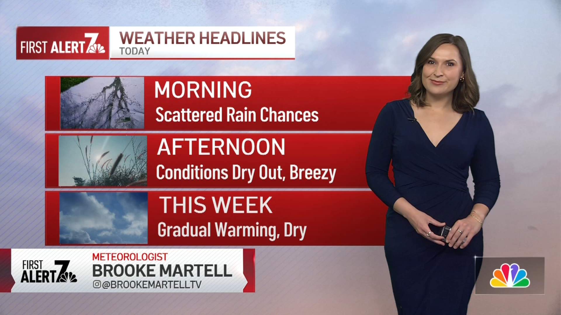
High pressure will set up to our northeast over the next few days, sending San Diego County an offshore flow. This will begin our warming trend on Tuesday, with the peak being Thursday. At that point, temperatures will be around 10 degrees above normal.
On Monday afternoon, the coast will be a bit breezy with elevated surf. Wave heights will be 3-6 feet, with sets expected to reach 7-8 feet. The highest surf will be on west-facing beaches in southern San Diego County, with a west swell.
Get San Diego local news, weather forecasts, sports and lifestyle stories to your inbox. Sign up for NBC San Diego newsletters.
On Tuesday, wave heights be a bit smaller, down to 3-5 feet, with some sets peaking at nearly 6 feet. That west swell means west-facing beaches will again see the best surf.
Wave heights will be lower the second half of the week, then building again this weekend as another weather system approaches.
Weather

Anybody in the water this week is being warned that rip currents will be dangerous for the next few days.
The waves this week won't be anywhere nearly as big as in January, when a pair of powerful storms washed ashore, pushing waves as high as 16 feet in some place, overflowing the boardwalk in Mission Beach and even damaging the seawall in La Jolla's Children's Pool.
A cold front with an associated area of low pressure will arrive this weekend. That will increase our onshore flow, cooling temperatures down both Saturday and Sunday. We could see a small rain chance on Sunday as well.
Coast: Sunny, breezy; mid- to low 60s
Inland: Sunny. mid-60s
Mountains: Sunny; mid-50s
Deserts: sunny, breezy; low 70s

