


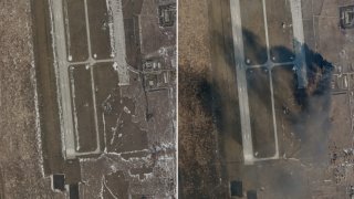
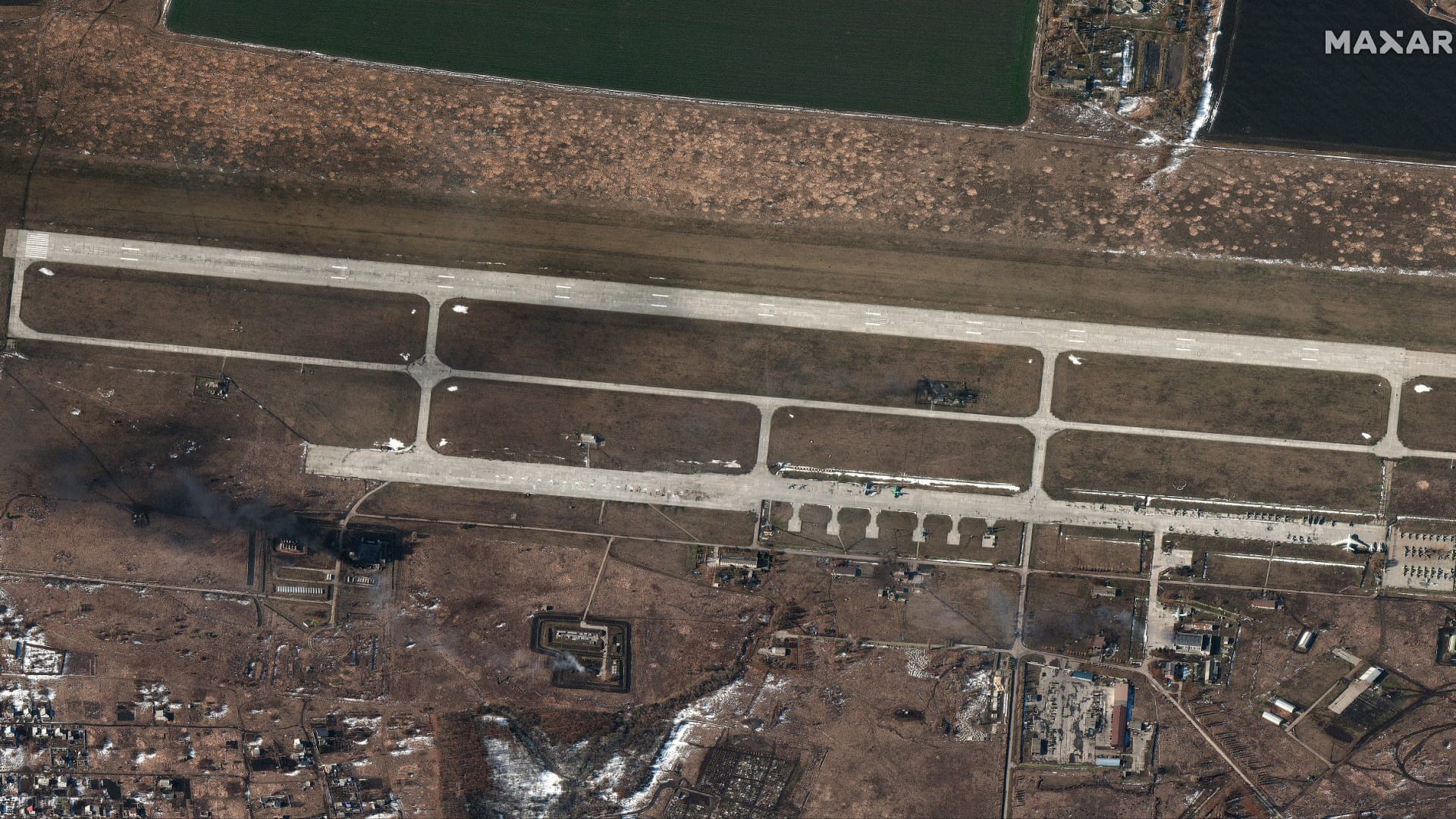
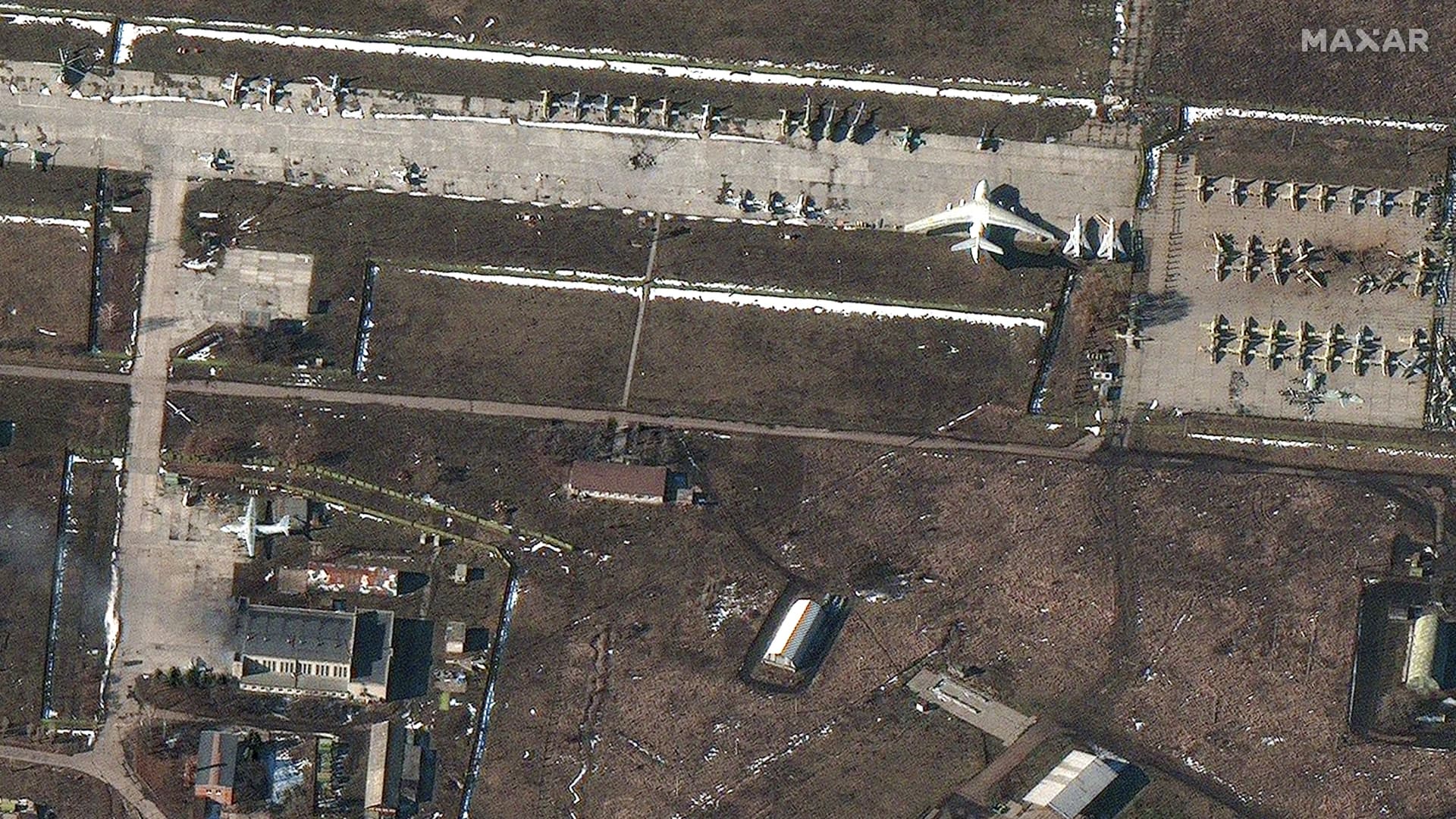
Satellite imagery of the Chuhuiv Airbase outside of Kharkiv, Ukraine on Feb. 21, 2022.
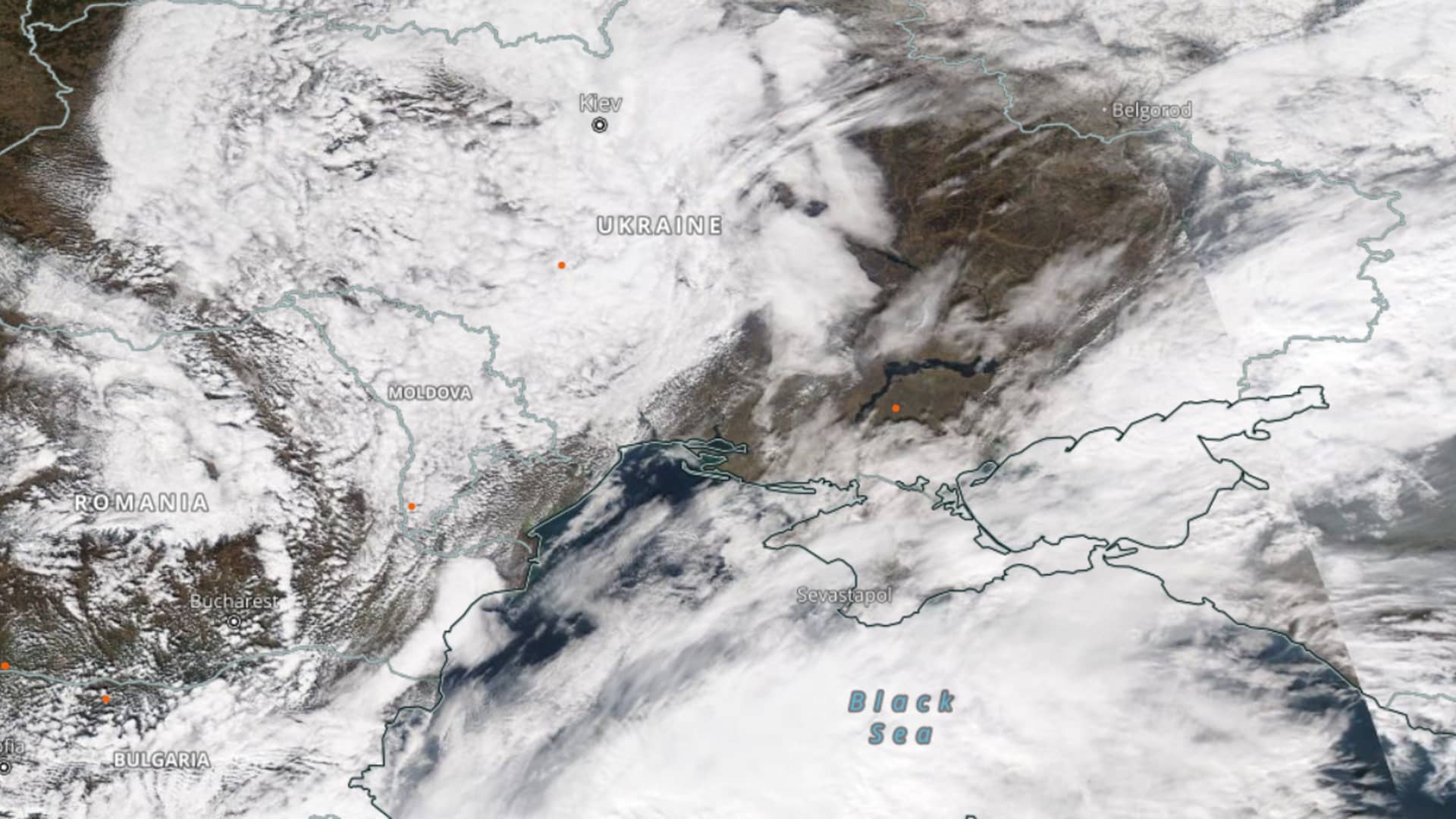
- Satellite imagery gives another perspective on the developing situation in Ukraine, as Russian troops move into the country and strikes occur in multiple Ukrainian cities.
- Imagery from U.S. company Planet shows a dark plume of smoke rising from Chuhuiv Air Base, outside of Kharkiv, Ukraine.
- About six miles east of the Ukrainian border, a military convoy was spotted by Maxar imagery near Sergievka, Russia – headed west toward Ukraine.
Satellite imagery gives another perspective on the developing situation in Ukraine, as Russian troops move into the country and strikes occur in multiple Ukrainian cities.
Russia launched an unprecedented invasion early on Thursday, with reports showing attacks by ground and air after Russian President Vladimir Putin announced a "special military operation."
Imagery from U.S. company Planet shows a dark plume of smoke rising from Chuhuiv Air Base, which is located outside of Kharkiv, Ukraine. The airbase was reportedly struck by a missile.
Get San Diego local news, weather forecasts, sports and lifestyle stories to your inbox. Sign up for NBC San Diego newsletters.
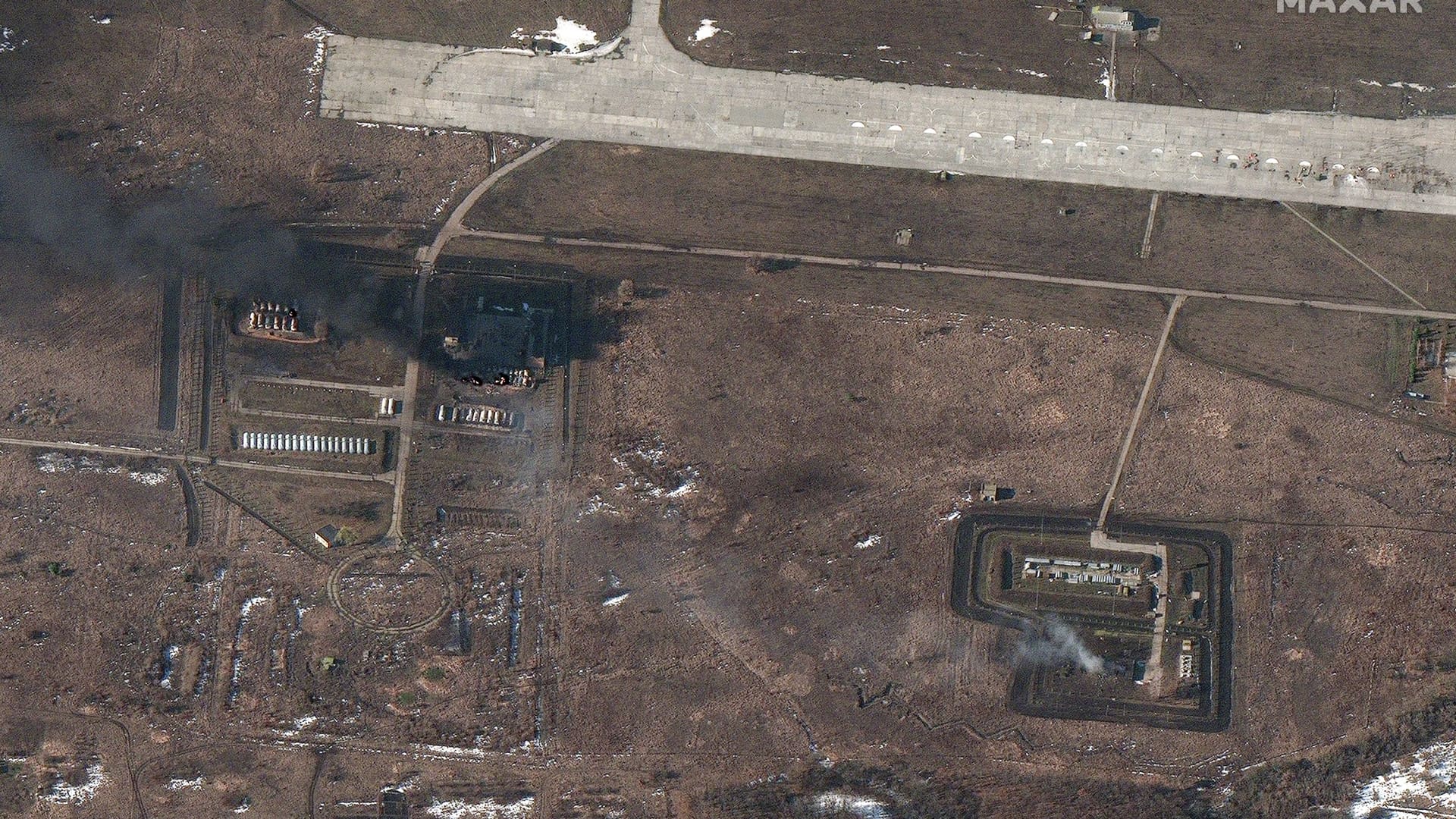
Space company Maxar captured more satellite imagery of Chuhuiv Air Base on Thursday, which showed more damage to fuel storage areas and other airport infrastructure.

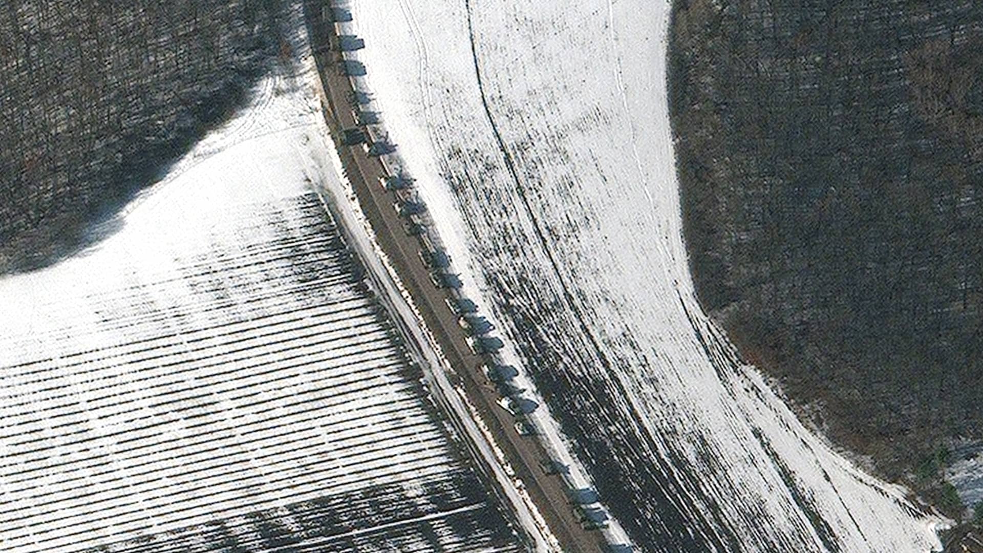
Further Maxar imagery showed military forces and more than 50 heavy equipment transporters at the Brestsky training area near Brest, Belarus.
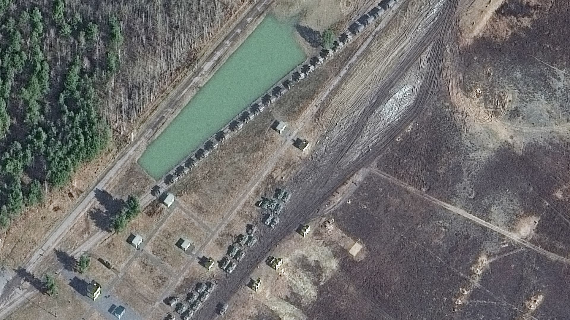
About six miles east of the Ukrainian border, a military convoy was spotted by Maxar imagery near Sergievka, Russia – headed west toward Ukraine.
Satellite imagery of the Russian invasion was limited earlier on Thursday, with cloud cover affecting the ability to see the attacks and troop movements from space — particularly in the southern section of Ukraine.