Top 7 Hiking Trails in San Diego

Got a favorite? Check to see if it's made our list.

8 photos
1/8
<a href="http://www.mtrp.org/directions.asp?idno=25">Cowles Mountain</a>: By far, Cowles Mtn. (pronounced โ€œCoalsโ€)* with its outstanding views at 1,591โ€™ above sea level, is arguably the most popular (and populated) trail in San Diego County.
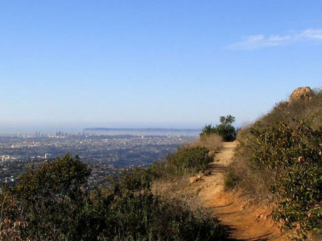
Mission Trails Regional Park
Cowles Mountain: By far, Cowles Mtn. (pronounced โ€œCoalsโ€)* with its outstanding views at 1,591โ€™ above sea level, is arguably the most popular (and populated) trail in San Diego County.
2/8
<a href="http://www.torreypine.org/parks/trails.html">The Trails of Torrey Pines State Natural Reserve</a> are not only easy to get to but can be a great outing for new hikers. The Beach Trail will take you from the top of the mesa to the waves below in less than a mile.
Bob Rossi
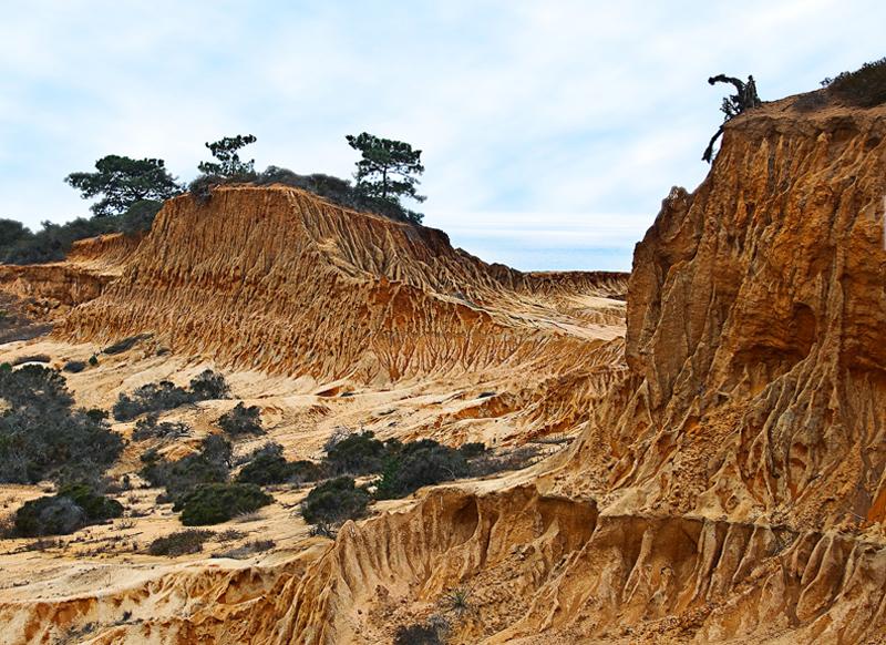
The Trails of Torrey Pines State Natural Reserve are not only easy to get to but can be a great outing for new hikers. The Beach Trail will take you from the top of the mesa to the waves below in less than a mile.
3/8
<a href="http://edweb.sdsu.edu/cab/#GI">Cabrillo National Monument Bayside Trail</a>:The two mile walk just east of the Old Point Loma Lighthouse offers spectacular views of San Diego Bay. Ask about the trailhead when visiting the Cabrillo National Monument.
Crรฉdito: eBay
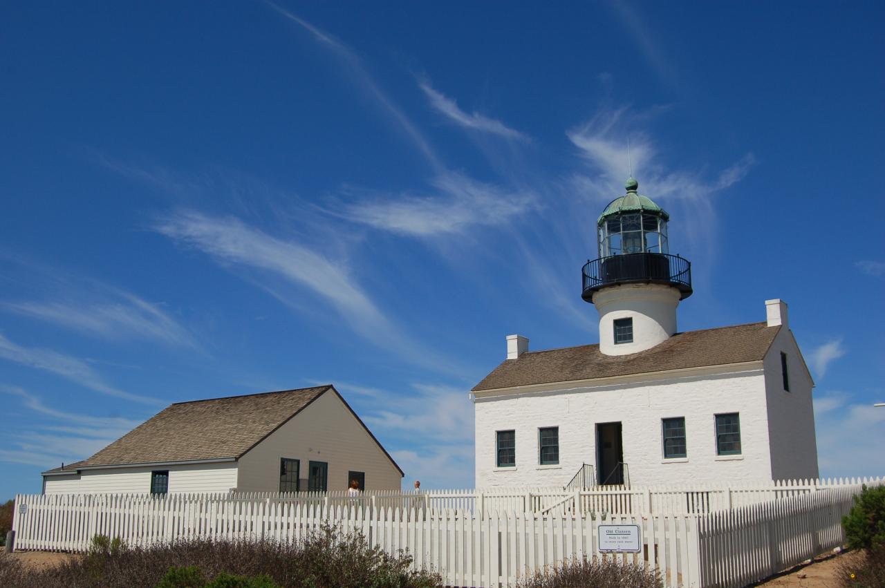
Cabrillo National Monument Bayside Trail:The two mile walk just east of the Old Point Loma Lighthouse offers spectacular views of San Diego Bay. Ask about the trailhead when visiting the Cabrillo National Monument.
4/8
Cooling off in the <a href="http://www.olivenhain.com/files/docs/Park/Parks/trail_map/trail-map2010.pdf">Elfin Forest</a>. The trails offer unique views of the North County.
Donald Stutler
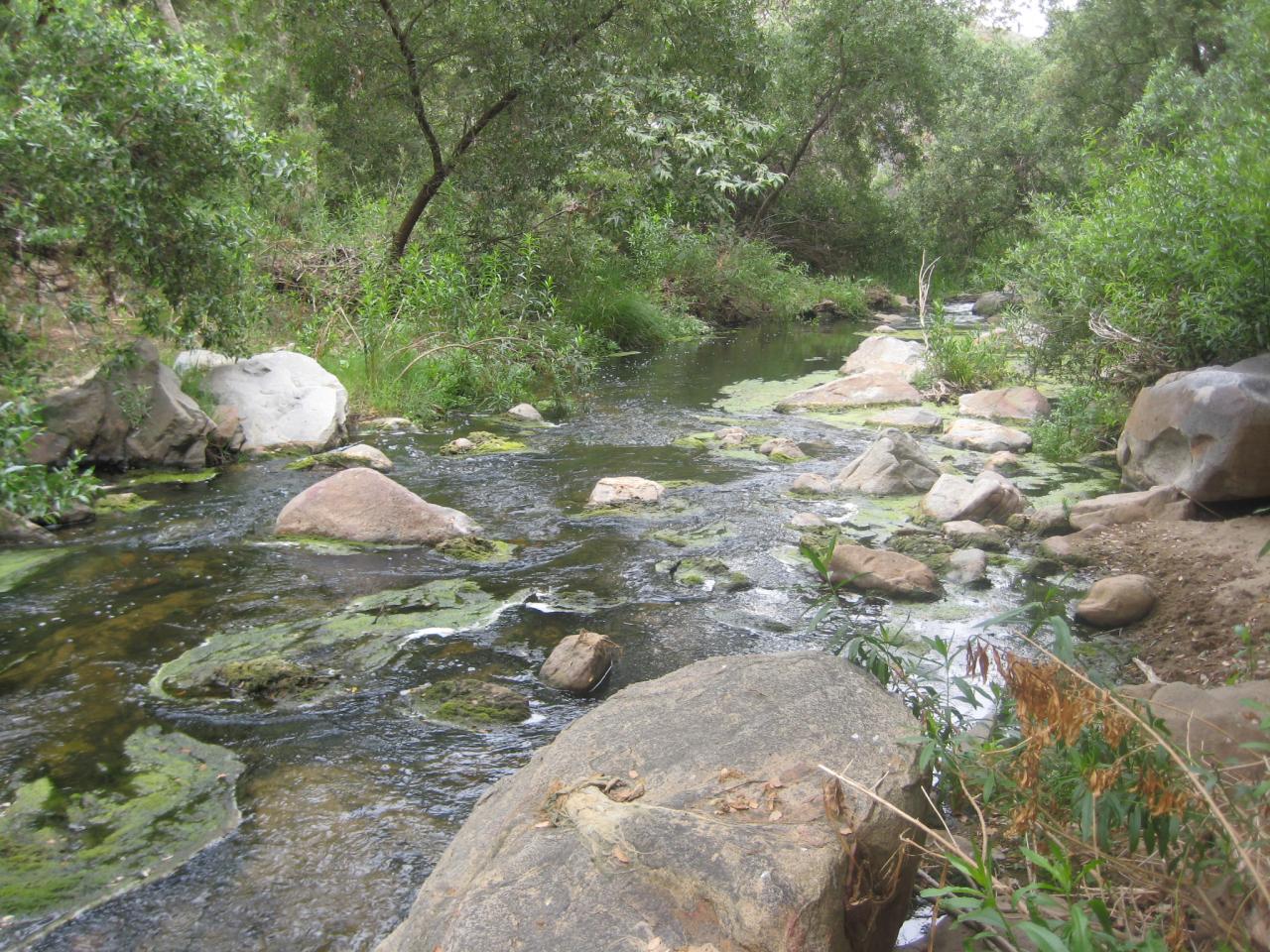
Cooling off in the Elfin Forest. The trails offer unique views of the North County.
5/8
For those who want adventure, there's always the Southern California section of the <a href="http://www.fs.fed.us/pct/southern_california_segment.html">Pacific Crest Trail</a> which begins at Campo and runs through the Laguna Mountains. This is a picture of Cuyamaca Peak from the Laguna Mountains.
NBC10
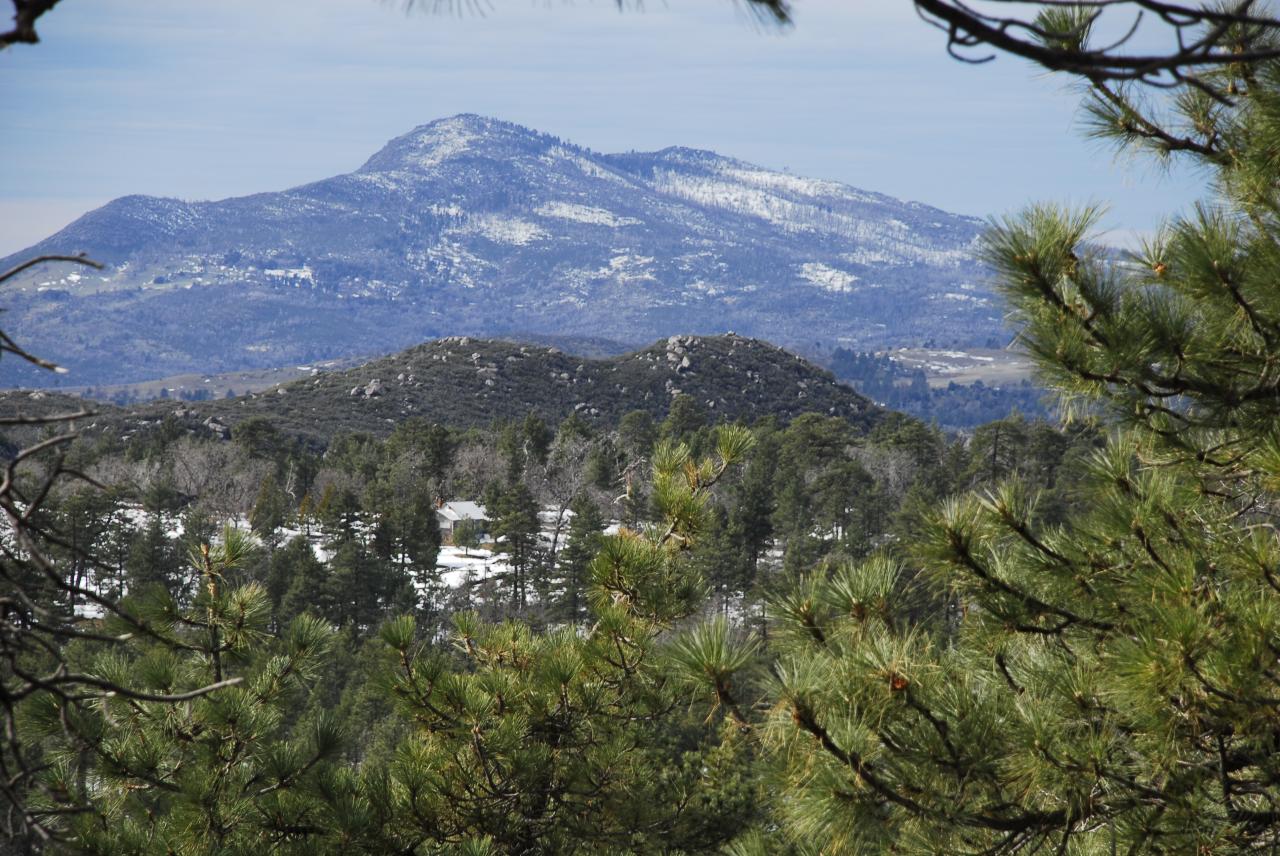
For those who want adventure, there's always the Southern California section of the Pacific Crest Trail which begins at Campo and runs through the Laguna Mountains. This is a picture of Cuyamaca Peak from the Laguna Mountains.
6/8
Drive over to Borrego Springs and try the <a href="http://www.parks.ca.gov/default.asp?page_id=25225">Borrego Palm Canyon Trail</a>. The challenging hike takes you to a beautiful, well-watered oasis, tucked away in a rocky V-shaped gorge. On the way there and back (3 miles) you may even spot some bighorn sheep in the hills.
Patrick Zondler
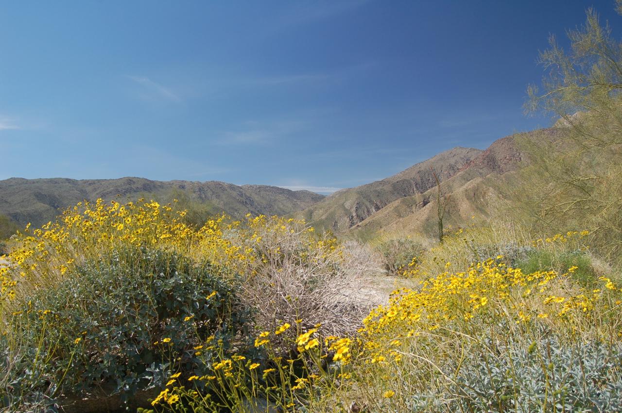
Drive over to Borrego Springs and try the Borrego Palm Canyon Trail. The challenging hike takes you to a beautiful, well-watered oasis, tucked away in a rocky V-shaped gorge. On the way there and back (3 miles) you may even spot some bighorn sheep in the hills.
7/8
Looking east from the top of <a href="http://www.ironmountainsandiego.com/">Iron Mountain</a>.  The 3-mile trail will take most hikers between 1-2 hours. There is a newly built parking area off Highway 67 and Poway Road. The view from the top is breathtaking.
NBCConnecticut.com
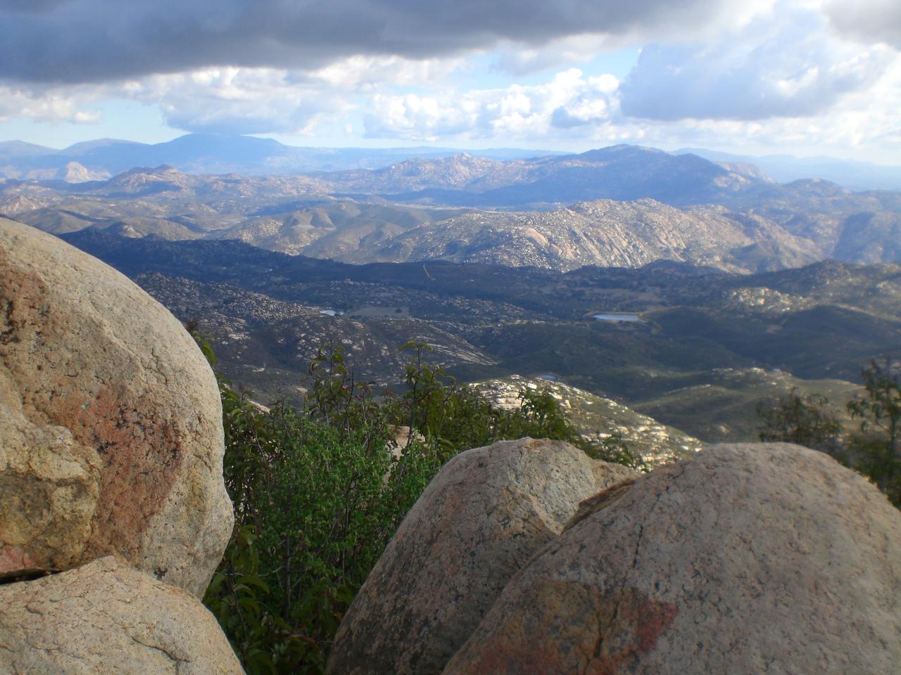
Looking east from the top of Iron Mountain. The 3-mile trail will take most hikers between 1-2 hours. There is a newly built parking area off Highway 67 and Poway Road. The view from the top is breathtaking.
8/8
Got a favorite we should add to our list? Send us a picture to isee@nbcsandiego.com or let us know <a href="http://twitter.com/nbcsandiego">via Twitter @nbcsandiego</a> or add your comment to<a href="http://www.facebook.com/NBCSanDiego"> our Facebook page. </a></p>
Got a favorite we should add to our list? Send us a picture to isee@nbcsandiego.com or let us know via Twitter @nbcsandiego or add your comment to our Facebook page.

Contact Us