
An unsettled atmospheric pattern was expected to move out of the San Diego area Monday evening, ushering in several days of mostly dry conditions beginning Tuesday -- one day after a cold winter storm brought downpours, mountain snow and high winds.
But another significant storm is expected to move over the San Diego area Thursday night or Friday, according to the National Weather Service.
San Diego County Weather

It will be mostly clear on Tuesday night.
As of early Monday evening, inclement conditions had delivered up to about three-fifths of an inch of precipitation along the coast and in the local deserts, a little more than an inch in the inland valleys, and almost 2 1/3 inches in parts of the East County highlands, according to the National Weather Service.
Topping the 24-hour rainfall tallies as of 5 p.m. were 2.31 inches on Big Black Mountain, 1.79 at Henshaw Dam, 1.76 in Mesa Grande, 1.58 in Pine Hills, 1.35 in Descanso and 1.34 in Pine Valley, the weather service reported.
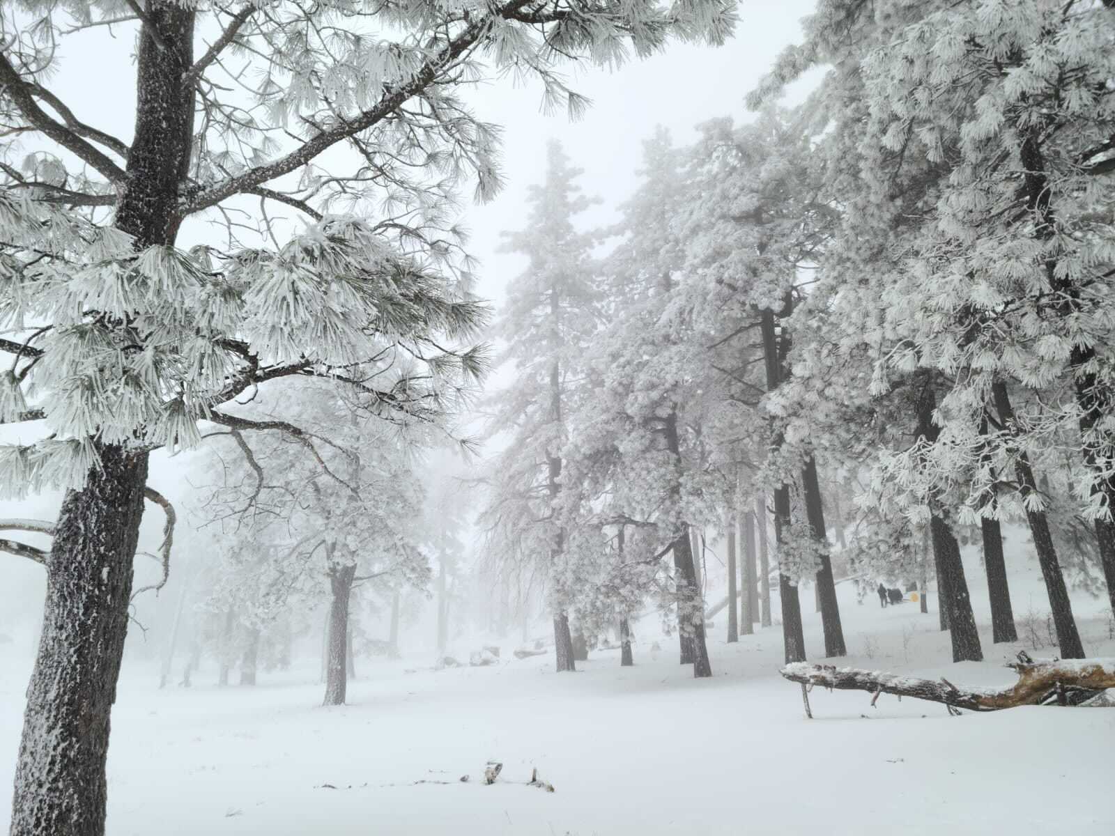
Photos: Winter Storm Batters San Diego County With Trifecta of Snow, Wind and Rain
San Diego County snowfall totals included 7 inches in Julian, the Mount Laguna area and Warner Springs; 2 inches in Ranchita; and a half-inch in Boulevard.
Icy conditions left by Monday's relentless winter storm prompted officials to close access to Interstate 8, where roads leading to San Diego County's mountain communities were slippery and dangerous early Tuesday.
By 8:30 a.m. Tuesday, eastbound and westbound lanes of I-8 were reopened, with California Highway Patrol personnel escorting vehicles. Chains were required on the slippery roads.
Droves of San Diegans flocked to the county's mountain region in hopes of being able to frolic in the fresh, powdered snow that was dumped in East County following Monday's storm.
Teresa Gray, who went with her family to Mount Laguna, said it was the first time she had ever put tire chains on her vehicle.
"I just had to crawl on my hands and knees to put these snow chains on and I had the oldest snow chains. There some really nice ones out there, but mine are not nice and had to put it on twice," Gray said. "Hopefully now we can get out of the slushy snow area and go to the pristine fun area."
The hillsides along roads up the mountain were full of kids playing, sledding and building snowmen.
The blustery conditions generated some notable winds across the county, including gusts with readings of 69 mph on Volcan Mountain; 65 mph at Fletcher Cove in Solana Beach; 58 mph on Otay Mountain; 56 mph in Crestwood and Del Mar; and 55 mph in Mission Beach and Potrero.
The storm created some public works problems across the region, including a flooded transition ramp on southbound Interstate 805 to state Route 52 in University City, shortly before 6 a.m.; a large downed tree across the roadway on East Grade Road at Conifer Road in Pauma Valley, about 8 a.m.; and another toppled tree blocking traffic lanes at Muir College Drive and North Torrey Pines Road in La Jolla, about 7:30 a.m., California Highway Patrol reported.
The weather service has issued a high-surf advisory until 6 p.m. Tuesday in local coastal areas and a gale warning through 10 p.m. Tuesday for ocean waters from San Mateo Point to the Mexican border.
