
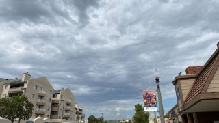
Monsoon moisture was moving back into Southern California from the southeast, and isolated showers or thunderstorms could develop over the mountains Sunday afternoon, forecasters with the National Weather Service said.
Increasing moisture and clouds Monday and Tuesday could temper the heat, but bring better chances for more widespread showers and thunderstorms, the NWS said. Some drying was possible after Tuesday, but small chances for mountain and desert thunderstorms may continue through the end of the week.
Thunderstorms began emerging in the Riverside mountains early Sunday evening, bringing the possibility of heavy rain, lightning, gusty winds and localized flooding to that area, NWS tweeted.
Get San Diego local news, weather forecasts, sports and lifestyle stories to your inbox. Sign up for NBC San Diego newsletters.
The shallow marine layer was expected to persist along the coast. Expected a limited amount of low cloud formations at night.
High temperatures along the coast Sunday were predicted to be 76 to 81 degrees with overnight lows of 64 to 69. Highs in the western valleys were expected to be 88 to 93, and 94 to 99 near the foothills with overnight lows of 66 to 71. Highs in the mountains were expected to be 91 to 98 with overnight lows of 67 to 73, and highs in the deserts were predicted to be 109 to 114 with overnight lows of 81 to 87.
Local


Northwest winds with gusts around 20 knots may occur over portions of the outer coastal waters between 30 and 60 nautical miles offshore later Sunday afternoon and early evening.
